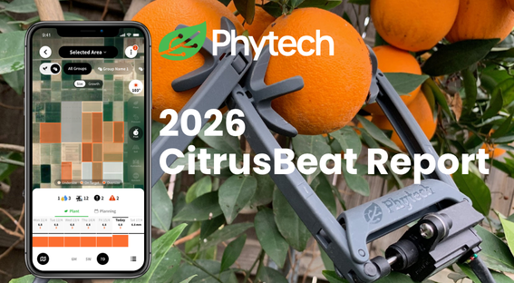
More Images. Higher Resolution. Lower Risk - At a Better Price.
- Phytech Team

- Feb 17
- 3 min read
Introducing High-Resolution Satellite Imaging in Phytech
Field issues rarely announce themselves clearly.
By the time irrigation irregularities, leaks, or uneven crop development are visible from the ground, yield or quality may already be affected. Walking the field shows symptoms. Satellite imaging shows patterns.
From Detection to Action
“Early detection changes everything,” says Tal Shilo, Product Manager at Phytech. “When growers can see variability within blocks at 10x10 ft resolution and track changes every other day, they gain time. And in agriculture, time is risk reduction.”
She adds: “What separates Phytech is that this imagery isn’t sitting in isolation. It’s part of a single platform that connects plant data, irrigation performance, and satellite insights. That’s what gives growers real confidence.”
From the field side, the impact is immediate.
“Many of our growers tell us the biggest value is knowing where to look before they walk the field,” says Customer Success Manager Yigal Goldman at .“They’re not reacting to visible damage — they’re responding to early signals.”
That’s why Phytech now offers High-Resolution Satellite Imaging — near-daily, ~10x10 ft resolution imagery powered by Planet satellites, fully integrated into the Phytech platform.
More images. Higher resolution. Lower cost. Real peace of mind in One Platform.
Why Frequency and Resolution Matter
Standard satellite imagery updates weekly. In fast-moving growing conditions, that can mean missing the early window for correction.
With near-daily updates and ~10x10 ft resolution, growers can:
Detect over- or under-irrigation earlier
Identify pressure issues and leaks
Monitor canopy wetness and nitrogen variability
Track variability within blocks, not just between them
Analyze trends across multiple seasons
Real-Life Examples
Spotting a trend developing


Yigal Goldman: "A relatively large section of the orchard did not receive water due to a blockage in the irrigation line. The progression of the damage can be seen developing over the course of the season?"
Avocado: Detecting Irrigation Non-Uniformity

"Avocado is highly sensitive to excess water. Using Wetness maps to identify non-uniformity in the orchard – resolved after replacing the irrigation piping", says Goldman.
Avocado: Trend analysis over the course of a month

Goldman: "Avocado is sensitive to excess water, so it is important to monitor wetness levels to ensure that increasing irrigation toward the start of summer does not lead to overwatering damage."
Avocado: Absolute VS. Relative helps reveal the truth

"Here, An orchard with the Hass variety located in the lower part of the field. From the grower’s perspective, all Hass trees were receiving the same treatment. An insight that emerged from the imagery: the three small southern plots showed lower vegetative growth compared to the rest of the field.
Vineyard: Absolute VS. Relative helps reveal the truth

The area outlined in red shows a section of the block with lower NDVI levels.
During the season, this area was treated as a separate sub-plot.
There is a correlation between NDVI levels and early or late ripening. Therefore, to improve wine quality from this block, this section can be harvested separately from the rest of the area.
What Separates Phytech
High-Resolution Satellite Imaging is not a standalone dashboard.
It is fully integrated into the Phytech platform — alongside irrigation data, plant monitoring, and operational monitoring and automation — all in one place.
What makes it different:
Higher frequency – near-daily updates
10x10 ft Planet resolution – see variability within blocks
Multiple actionable layers – vegetation, wetness, nitrogen, anomaly detection
One platform – no switching tools, no disconnected systems
This integration means growers don’t just see anomalies. They connect them directly to irrigation decisions.
Designed for Commercial Growers at Scale
This offering is built for medium to large orchard and row crop operations managing irrigation across multiple blocks.
With special pricing currently available, growers can now access near-daily high-resolution satellite imagery at a lower cost — making advanced visibility more accessible than ever.
More images. Higher resolution. Lower cost. Fewer surprises.


Welcome to level devil - not a troll game, a platformer that promises it’s not trolling you… probably. Just when you think the path is safe, the floor disappears or spikes pop out of nowhere. Don’t worry, the game isn’t evil, it just enjoys watching you panic a little.
Türkiye’de tütün ürünlerini tüketen milyonlarca vatandaşın gözü kulağı her sabah tekel bayilerinden gelen fiyat listesi güncellemelerinde. Özellikle son dönemde yaşanan ekonomik dalgalanmalar, döviz kurundaki hareketlilik ve ÖTV (Özel Tüketim Vergisi) artışları sonrasında sigara fiyatları cepleri doğrudan etkilemeye devam ediyor. Peki, sigaraya zam geldi mi? 3 Nisan 2026 itibarıyla güncel durum ne?
I appreciate how Techsslaash consistently publishes high quality content related to technology and online trends. The articles are informative without being overly complicated, making them accessible for a wide range of readers. It is clear that a lot of effort goes into researching and presenting useful information. This blog is definitely a great resource for staying updated with the fast changing digital world.
If anyone likes skill-based browser games, eggy car is worth checking out. The hills get much harder the farther you go.
In Geometry Dash Lite, every second is filled with action. The cube runs through glowing levels at a constant speed. Obstacles appear in rapid patterns. Players must rely on quick reflexes. The soundtrack guides your timing naturally. Jump pads and rings create dynamic movement. Gravity portals reverse your direction instantly. Success depends on consistency.