See What the Field Is Telling You.
Before It Becomes a Problem.
Introducing Hi-Res Satellite Imagery in Phytech – near-daily, 10 ft² satellite views that help you spot issues early, reduce risk, and act with confidence across your entire operation.

Early Access Pricing (Washington Row Crops Growers)
Starting from $2 per acre*
*Pricing varies based on acreage and coverage selection
Confidence From Above
Hi-Res Satellite Imagery gives you a clear, whole-field view of crop development, moisture, nitrogen, and anomalies – so you can catch problems early, prioritize scouting, and avoid costly surprises.
Built directly into Phytech and powered by multiple satellites, including Planet's 10x10 ft high-resolution satellites, this new capability turns satellite data into practical, day-to-day decisions.

What You Can Detect Early
What looks uniform on the surface often isn’t. Hi-Res imagery reveals variability that would otherwise go unnoticed until it’s too late.
Irrigation malfunctions and leaks
Uneven water distribution
Nitrogen variability
Crop stress and abnormal patterns
Operational issues that are hard to see from the ground

Resolution and Frequency Matter
A level of clarity allows you to understand where to scout, what to check, and when to act.
10 ft² resolution – see variability within blocks, not just between them
Near-daily imagery – follow changes as they happen, not weeks later
3+ years of image history – analyze trends across seasons


Multiple Actionable Layers:
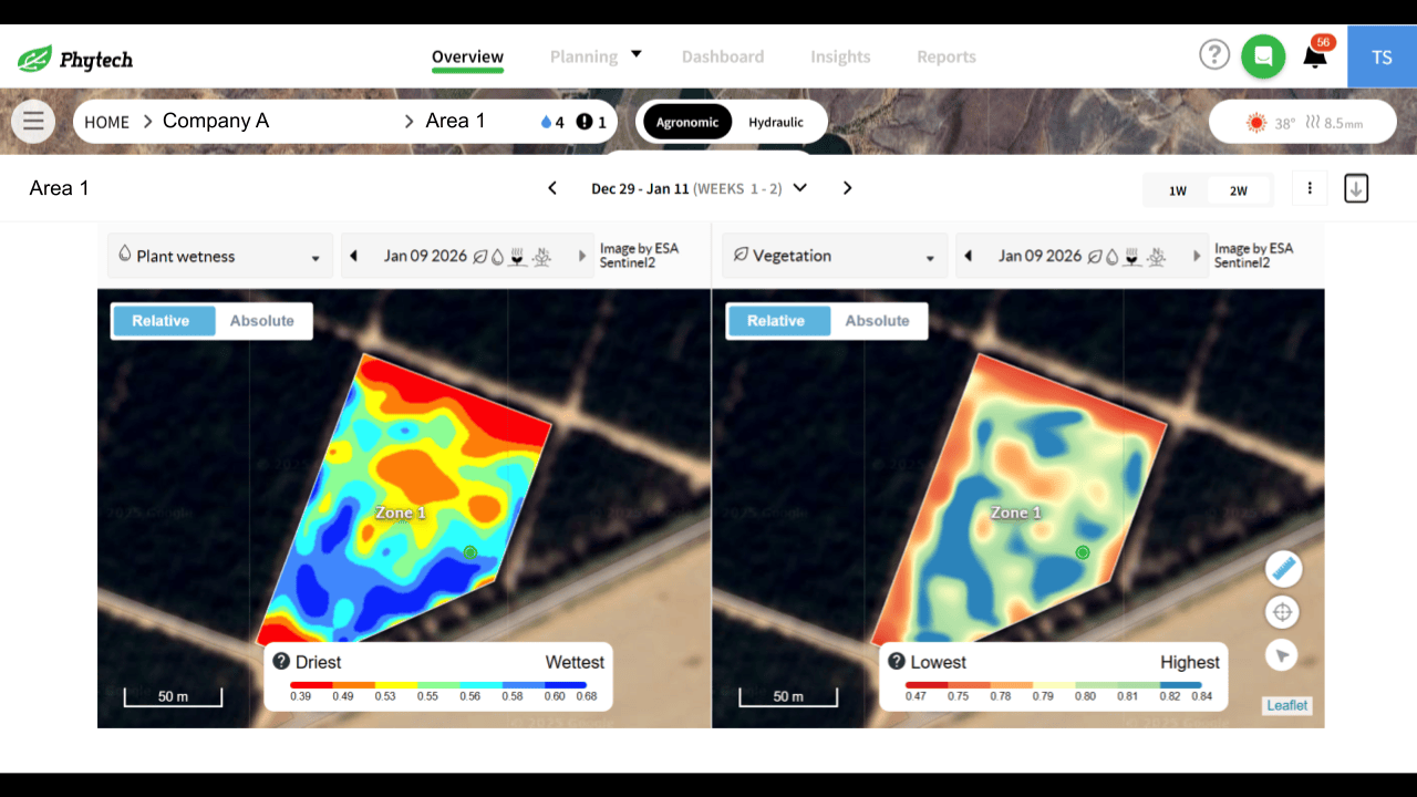
All layers are available at both area level and block level, directly inside Phytech.
Vegetation development
Canopy moisture (wetness)
Nitrogen content (relative)
Inter-plot
Automatic anomaly detection
Use Case: During the Season
Monitoring effect of operational actions
In this real-life example from Israel, Corn:
The image was taken after the pivot had finished a rotation. You can see that the part of the pivot that was irrigated latest are relatively more wet while the western half of the field that was irrigated prior are already drying.
